01
Residential developments
Show phases, buildings, courtyards, parking, play areas, planting, and pedestrian routes.
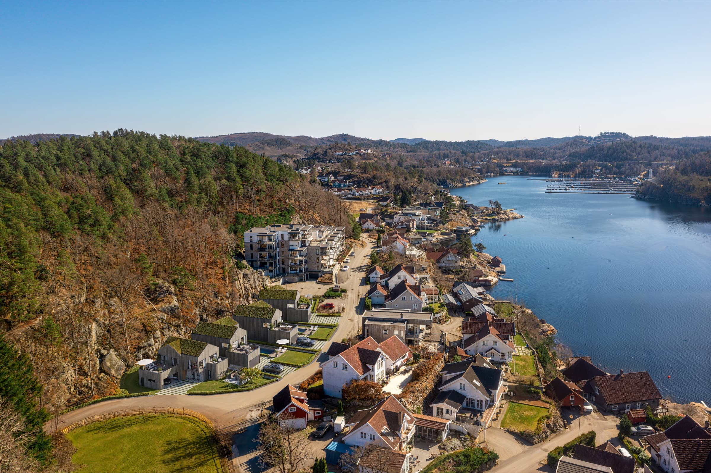
Site Plan Rendering
A flat master plan is useful to the project team, but buyers and investors may struggle to understand scale, building relationships, landscape, access, and amenities.
A three-dimensional site view combines source accuracy with presentation clarity. Detail is planned around site size, camera distance, and the final placement.
Architectural Visualization
Show phases, buildings, courtyards, parking, play areas, planting, and pedestrian routes.
Explain homes, plots, roads, shared spaces, amenities, and the natural setting.
Present functional zones, access, parking, logistics, and links to urban infrastructure.
Business outcome
The viewer quickly understands development structure, distances, and the role of each zone.
Landscape, courtyard privacy, accessibility, and amenities can be clearly emphasized.
The rendering supports websites, decks, catalogs, orientation graphics, and investment material.
Included
Site Plan Rendering
We review CAD, PDF, BIM, site boundaries, building positions, terrain, and the zone legend.
We decide what must remain readable at output scale and what can be simplified.
The site, buildings, and landscape are assembled around a view that keeps priority zones visible.
Placement, colors, phases, and labels are checked before the required files are exported.
Commercial terms
Before production, we define source material readiness, review milestones, and the exact output set so the quote reflects the real scope.
Plans, elevations, sections, CAD/BIM/3D files, materials, references, and a view list. Missing information is completed through an agreed brief.
Source review before the final quoteTiming depends on scene scale, model readiness, image or viewpoint count, and detail level. Milestones and dates are stated in the proposal.
Schedule follows a technical reviewFeedback is consolidated at preview milestones. Revision rounds and the boundary between corrections and new scope are agreed before work starts.
Clear review stages and scope boundariesWe deliver agreed assets for web, print, presentations, or video. Resolution, source scenes, and usage rights are specified separately.
The final package matches its delivery channelsAccuracy and communication
A strong site plan rendering balances technical fidelity with fast visual comprehension. It avoids detail that disappears at scale while retaining the relationships that matter.
Building placement, roads, boundaries, primary levels, functional areas, and project phases should follow approved source information.
More atmosphere, landscape, and context for buyers.
Clear zones, labels, and orientation logic.
Scale, phases, transport, and surrounding context.
A master plan can be supported by human-eye views when the presentation needs more detail.
Site Plan Rendering
An up-to-date CAD or PDF master plan, site boundaries, levels, building models or drawings, landscape information, and a list of the zones that must be communicated.
Yes. Separate phase versions can be rendered, or status can be communicated through color and labels.
Yes. Labels, legends, and markers are planned around readability at the final output size.
A bird’s-eye exterior can be more atmospheric and architecture-led. Site plan rendering prioritizes complete-site readability and relationships between zones.
Yes, provided the required print dimensions and viewing distance are agreed before final rendering.
We create visual and digital solutions for developers, architects, and real estate companies. Our team helps present projects before construction is completed, strengthen sales materials, and make communication with potential buyers clearer and more convincing.